
"How far did you go?" "How long did it take?" For a human the answers are often as close as the nearest bicycle cyclometer or GPS. For a dog... well, for a dog the answer has always been something like, "She runs at least twice as far as I ride." Or maybe, "I don't know, I only saw my dog a few times during the hike." Realistically, we don't have any idea how far our dog has run, or sometimes even where he has been. I always swore our Brittanys Maggie and Angie ran at least 50% more than I rode on long rides. But who really knows? And that is the raison d'être in our latest quest for knowledge. Using modern GPS technology we decided to determine just how much farther a dog runs while accompanying bike riders on a long (~20 mile) trail ride.
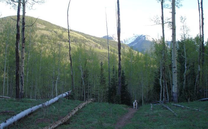
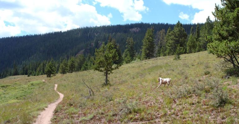
All summer long we exercise outdoors with our trusty dogs at our side. Up mountains, down valleys, over hill and dale.
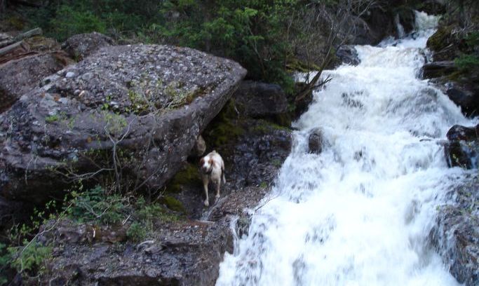
Over rocks and through streams...
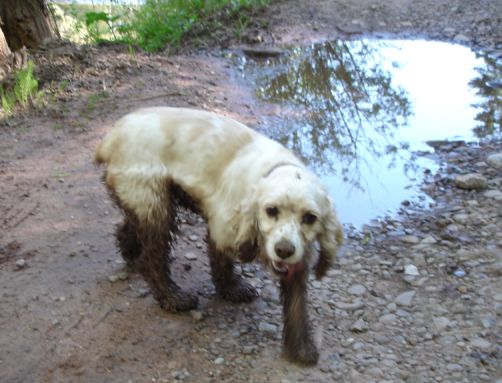
... and lots and lots of mud. (This is our friend Cindy's Cocker Spaniel "Chloe" - she's a real dirty girl.)
During these summer rides our dogs enjoy the chance to stretch their legs, smell the wilderness and perhaps get a bit tired. On the uphill climbs our faithful companions often stray far afield, knowing they can always find the slowpoke human. On the downhills they quickly learn to stay fairly close lest they be left behind. Nevertheless it seems likely that they run a lot more than we ride. And our mission was to determine exactly how much more...
The participants for this experiment were:
me  Jimmy Latter
  Duke
Duke  my mom's Brittany Margo.
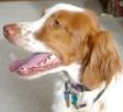
Duke is around 3-1/2 years old (we don't know his true age but that is the vets best estimate) and very healthy. He has been riding trails all summer, with just one 15 day activity-break in July to rest a strained right front shoulder. His recovery has been splendid with no apparent lingering damage. Margo is of similar age, perhaps a tad younger. She is also a rescue dog from Texas. Duke is quite stocky and atypical of the breed while Margo is slender and springy with supermodel-like long legs. Jimmy and I are both over 40 - neither of us has supermodel legs no matter how much we try to convince the ladies otherwise.
The ground rules were simple. We would ride Reno-Flag-Bear-Deadman, a twenty mile loop from the Deadman trailhead. The Garmin Forerunner 301 GPS would be started when everyone was ready to depart the trailhead. We would ride a normal pace, both uphill and downhill. We would call the dogs if necessary, i.e. when we were ready to get going again after a break, but otherwise let them run. All this is S.O.P. on our rides and quite familiar to Duke. He ran the trail earlier this summer but it was Margos first time here. Upon return to the trailhead parking lot we would stop the GPS and record the results.
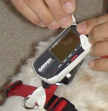
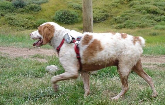
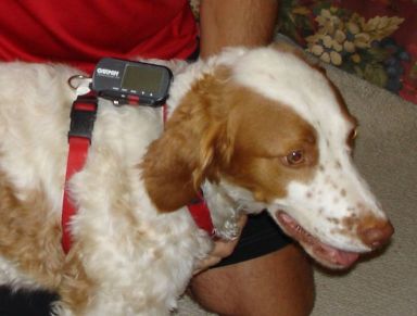 Preparation was key, and attaching the GPS to Duke became a small challenge. Affixing the GPS to his collar failed miserably as the GPS kept rotating underneath his head no matter how much we tightened the collar. Finally we hit upon the idea of using a harness with the GPS attached to an upper strap. This was definitely our best option, requiring just a bit of waterproofing tape to ensure Duke would not drown the GPS in a beaver pond or stream.
We drove to the Deadman trailhead mid-morning and unloaded gear, bikes, and dogs in that order. The weather was beautiful and the forecast called for continued partly cloudy skies all afternoon. With everyone chomping at the bit, we started the GPS timer and set off on our adventure.
Both Duke and Margo bounded all over as we rode up Cement Creek road. They were in and out of the creek, mud puddles, and willows lining the water. About two miles later we turned right onto the single-track shortcut to Italian Mountain road. The climb is just under four miles long, and at the two mile point we ran into a friend and good neighbor, David Baxter.
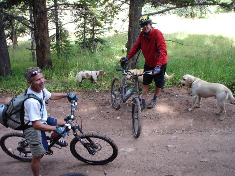
Dave had ridden with his young Labradors Mela and Koda from Cement Creek Ranch all the way up the difficult first half of the Reno Divide climb. As you can see, Dave is turning his hardtail bike around for the ride back downhill, probably because his dogs were getting tired. As a long-time pilot familiar with modern technology, Dave applauded our innovative use of the freely available GPS signals emanating from satellites in the sky. Dave guessed that Duke would run 25% more than we rode. We made a note of his guess, said our goodbyes and continued on the journey.
We soon reached the Reno Divide saddle, our riding time very much in line with our normal pace. We stopped for a few minutes, wringing out sweatbands and donning helmets for the exhilarating ride down Flag Creek. During this time the dogs ran all over, smelling the scent of bikers, motorcyclists, ATVers, 4-wheelers, and animals of every kind who frequent the Reno Divide saddle. You can see Duke's track at the top middle of this image. Also note the suspiciously straight line leading from the left side to the middle mess - we'll discuss that anomoly later.
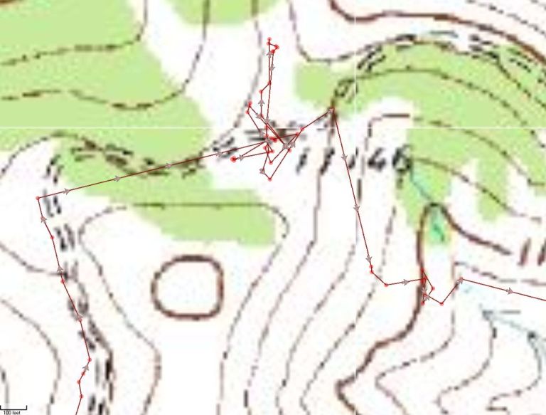
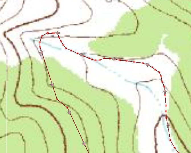
On the Flag Creek descent we stopped once to ensure the dogs were still with us (they were just a few seconds back) and then continued on. Eventually we climbed up along Bear Creek - our slow pace gave the dogs a chance to run all over creation once again. The image below shows a bike rider's track going from bottom right up and to the left, then turning 180 degrees at the top of the climb onto a Forest Service road which meanders along the contour for a mile before topping out in a nice meadow. Compare the GPS track for a human rider shown here...
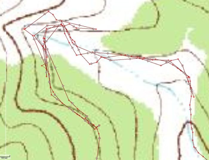
... with Duke's track shown below. Duke and Margo "lost" us for a bit here, I had to backtrack from our lunch spot and round them up later. Looks like Duke backtracked downhill to the right quite a ways looking for us before returning to the FS road.
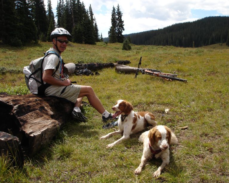
After I retrieved them, Margo and Duke joined Jimmy for a short break at the top of the Bear Creek downhill. Yes, Jimmy appears to have some kind of animal magnetism that calms dogs... Margo and Duke remained still for at least thirty seconds.
Duke explored the hillside during the Bear Creek downhill:
At the bottom of the Bear Creek downhill we took another short break and noticed that Duke's GPS was noticebly drooping to one side. Unfortunately the internal GPS antenna is pointing down and back, perhaps causing some loss of GPS signal.
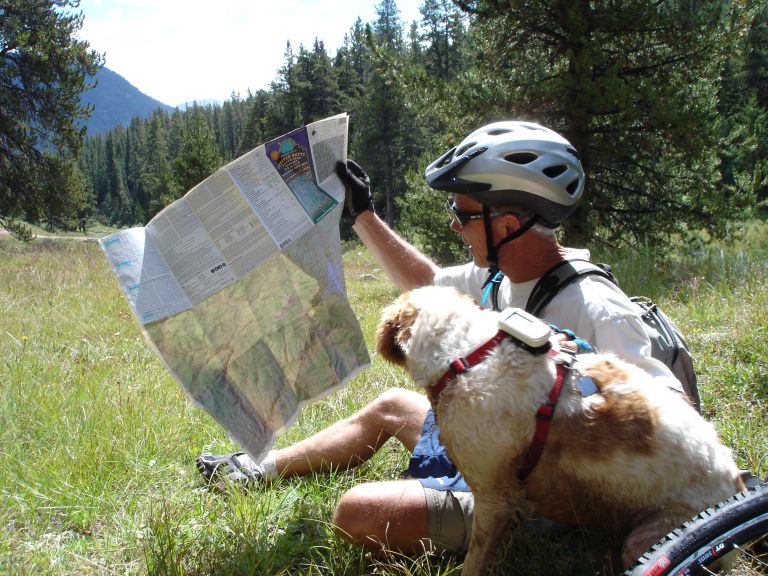
Duke and Jimmy decided to examine the map to make sure they knew which trail to follow.
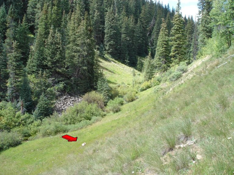
We had a fine time climbing up Deadman Gulch, the last uphill of the ride. Duke is barely visible so we added a magic red arrow to highlight his position way below us in the gulch. This ride has plenty of water along the way so the dogs really enjoy themselves.
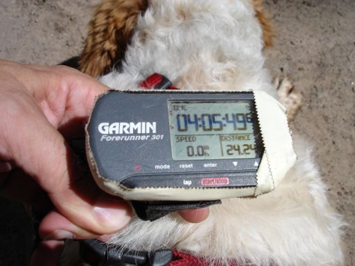
After successfully navigating all thirty-one switchbacks down from Deadmans, we arrived at the trailhead and stopped the GPS timer. The time is total time on the trail, not moving time. Distance as calculated by the GPS device itself is 24.24 miles.
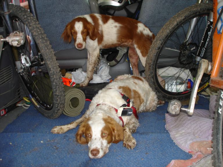
Both Margo and Duke were quite tired and quickly found a spot to rest in Jimmy's van. Duke's GPS is still drooping.
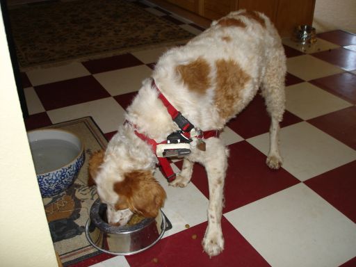
Back home Duke got what he really wanted, a nice bowl of high quality organic dog food. Afterwards he retired to his bedroom for a nap.
So what about the results of our experiment? We used some software I've been employing for a few years, something called SportTracks. SportTracks is a free Windows-based package which imports data from popular GPS devices and maintains a log of your workouts. It has many features for athletic training as well as a cool map upon which your GPS track is overlayed. The topo images above were captured from SportTracks. Anyway, I have cycled this ride twice before with my GPS and used that data to compare with the results of Duke's run.
We asked a number of local experts to estimate how much more Duke would run than we rode: Graham - 50%, Jimmy - 40%, Dave Scheefer - 33%, Mrs. Flyingcracker - 30%, Dan Ewert and Dave Baxter - 25%. The average ride length, as reported by the Garmin Forerunner 301 GPS on my earlier rides, was 18.4 miles. Duke's excursion, as reported by SportTracks using data from the same Garmin GPS, was 21.8 miles. So the difference was just 18.5%! Dan Ewert and Dave Baxter were closest at 25%, but even they were a good ways off.
Discrepancies. Yes, we had discrepancies. As you can see in the end photo above, Duke's GPS reads 24.24 miles. Yet SportTracks reported 21.8 miles. We feel that the SportTracks software is actually more accurate based on a more intelligent analysis of the GPS track data. We considered any movement under one mile per hour to be a standstill. Believe me, Duke hardly ever stands still and so the Garmin likely added mileage that really wasn't there. Then there is the issue of the droopy GPS and thick foliage / tree cover. Here is where the experiment gets a little hinky. If you closely examine the GPS track of Duke's run coming down the Deadman switchbacks you notice a strange path:
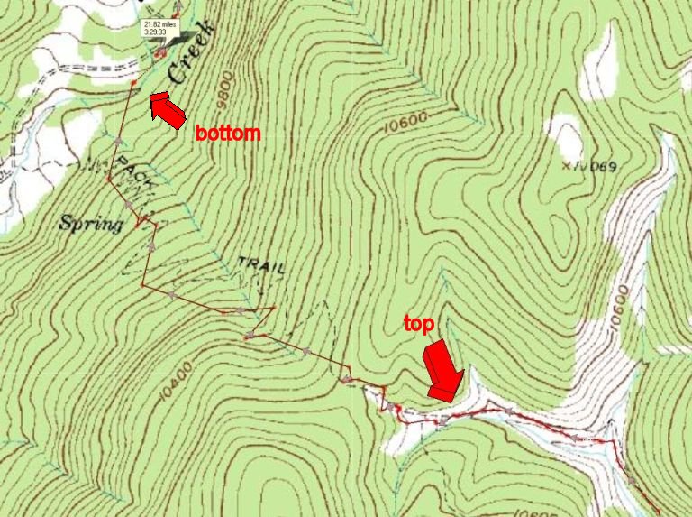
Remember how we said that there are thirty-one switchbacks on this section of the ride? Do you see thirty-one switchbacks in the path from the top arrow to the bottom arrow? Neither do we. And therein lies the problem. The Garmin Forerunner GPS is a great device, but only accurate with a clear view of the sky. If you look at the earlier image showing Duke's track at the top of the Bear Creek climb you will notice a lot of straight lines. Same thing at the top of Reno Divide. These indicate periods when the GPS did not get a solid signal. On the Deadman switchback downhill the entire descent is made in heavy tree cover, causing problems for GPS reception. The sagging GPS harness probably didn't help matters any.
Given the significant problem of obtaining decent GPS reception on a good portion of the ride how can we proclaim that Duke ran 18.5% more than we rode? A fair question to be sure. Our answer is that the GPS had just as much trouble with our earlier rides as it did mounted on Duke. Thus the margin of error is quite likely similar. In fact, on my two earlier rides the GPS mounted on my handlebars recorded nearly the same distance each time at 18.41 and 18.44 miles. We are certain that none of these readings is perfectly accurate but they were taken under identical atmospheric and foliage coverage conditions as the run Duke performed. Thus we are comparing apples to apples, however bruised they may be.
For you statisticians, according to the Garmin GPS Duke ran 21.8 miles in 3:29:33, resting for 34:47. He climbed 3,460 feet, averaged 6.2 mph, and had a fast speed of 14.7 mph. In my previous rides we averaged 18.4 miles in 3:05:14, resting for 40:22. We climbed 3,029 feet, averaged 6.0 mph and achieved a top speed of 14.9 mph. We did not bother with the wireless heartrate monitor - human and canine physiology is different enough that we just didn't care.
In conclusion, we feel that Duke's running distance of 18.5% more than our riding distance represents a reasonably accurate estimate based on the most modern data acquisition techniques we could muster. We hope to someday obtain the new Garmin Edge 305 GPS with vastly improved satellite GPS signal reception and a barometric altitude sensor for more accurate data capture. If / when that happens we'll revisit this experiment and report again on our findings. After all, "inquiring minds want to know..." and all that rubbish. Until then you can feel very confident in our research. Feel free to quote our results in your next email to your mother. And please send your comments and/or suggestions to us at flyingcracker.com. Happy trails!
[Note: This series is continued in Run, Duke, Run! Chapter Two.]